Elbow Traverse
(Glasgow, Cornwall, Outlaw & Banded Peaks)
2020 August 5
with...
Jessica Jiang,
Rob Walker
2020 August 5
Jessica Jiang,
Rob Walker
I wasn’t sure which shot to use for the trip's title shot: the iconic view of the four peaks (below) is immediately recognizeable as part of Calgary’s skyline, visible looking west towards the mountains from parts of the City with enough elevation to see them. The same glacial activity that makes the four peaks so distinct is what gives you that elevation. I find a kind of poetry there.
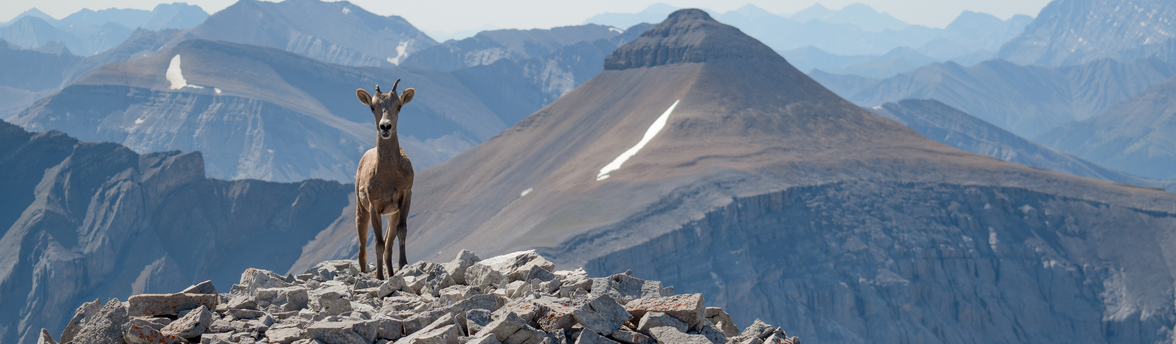
You’re less likely to have seen this collection of peaks from the summit of the first looking across to the fourth, and it's almost certain that you'll not have had the opportunity to meet Sandy. So it makes sense to lead with the two-shot of her with Banded Peak: it's a new angle on a familiar scene for you, if you know Calgary's skyline. And I can more properly introduce you to our friend. That's her in the shot above, standing on Glasgow's summit with Banded Peak to her left (and your right 😊).
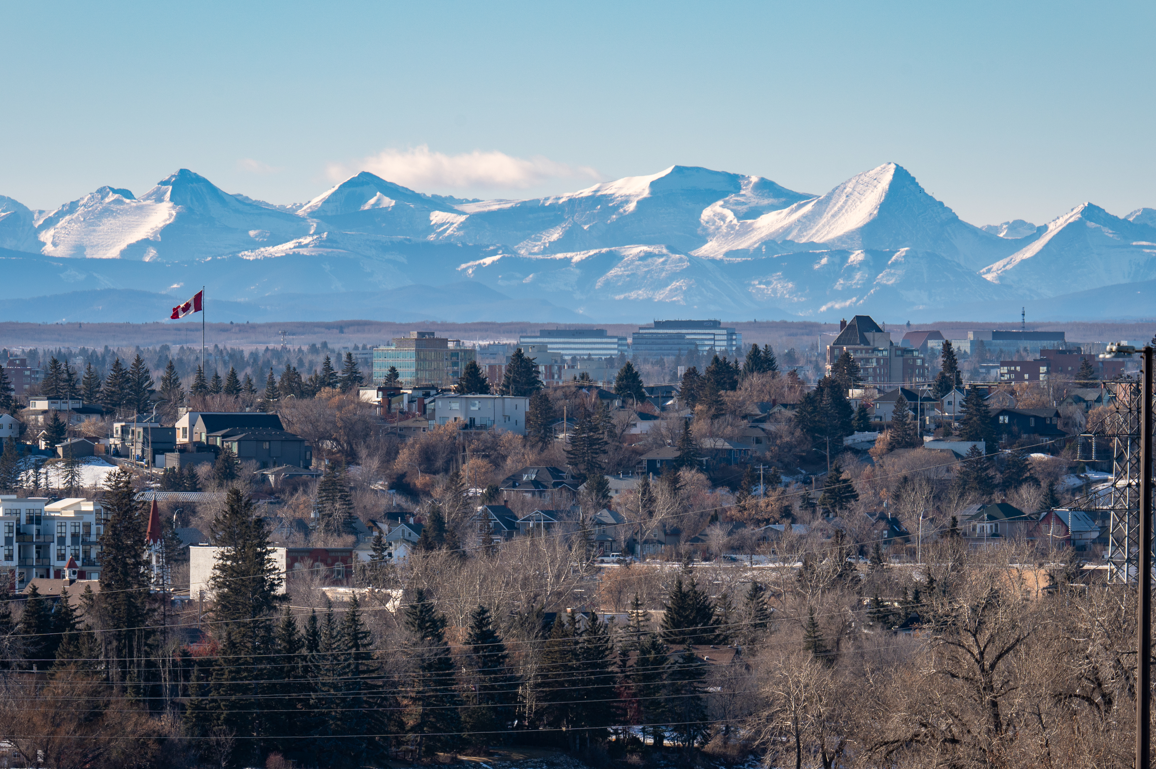
(from right: Glasgow, Cornwall, Outlaw and Banded Peak. Snapped from Mayland Heights. The view from Tom Cambell's Hill near the Zoo has the downtown in there, but there's a big yellow crane in the way ☹️. Hope this one's OK?)
Friends & I had scrambled Mount Glasgow as we worked our way through the first edition of Alan Kane’s guide1 back in the early 90s and I’d been in there a few times since, including a shot as a ski trip back In 2015. Later that same year, I found Daniel So’s trip report from his 2011 traverse2 that included Glasgow with the other three peaks in the cirque as a day trip. It was one of those, “why didn’t I think of that?” moments and since then, this traverse has been part of a collection of favourites that I hit every few years. Most often it’s a late-in-the-day decision that lands me up there alone the next day, though sometimes a friend will join.
Apart from ascending Glasgow's west ridge to gain the first summit and a more direct descent of the NE face of the last, my route looks about the same as Daniel’s. Except for this downclimb, movement stays inside third class and exposure is avoidable. The descent nudges into fourth class. Daniel’s route instead descends Banded Peak along its north ridge and into the next valley. His is likely more scenic choice and almost certainly less technically demanding. I might try his descent my next time through.
I’ve included shots from a trip with a friend during the heat dome in August of 2020. And an inversion: Jessica & I were already baking at 30C in the valley and temperatures notched up a degree or two from there, as we gained each of the four summits.
Hot!
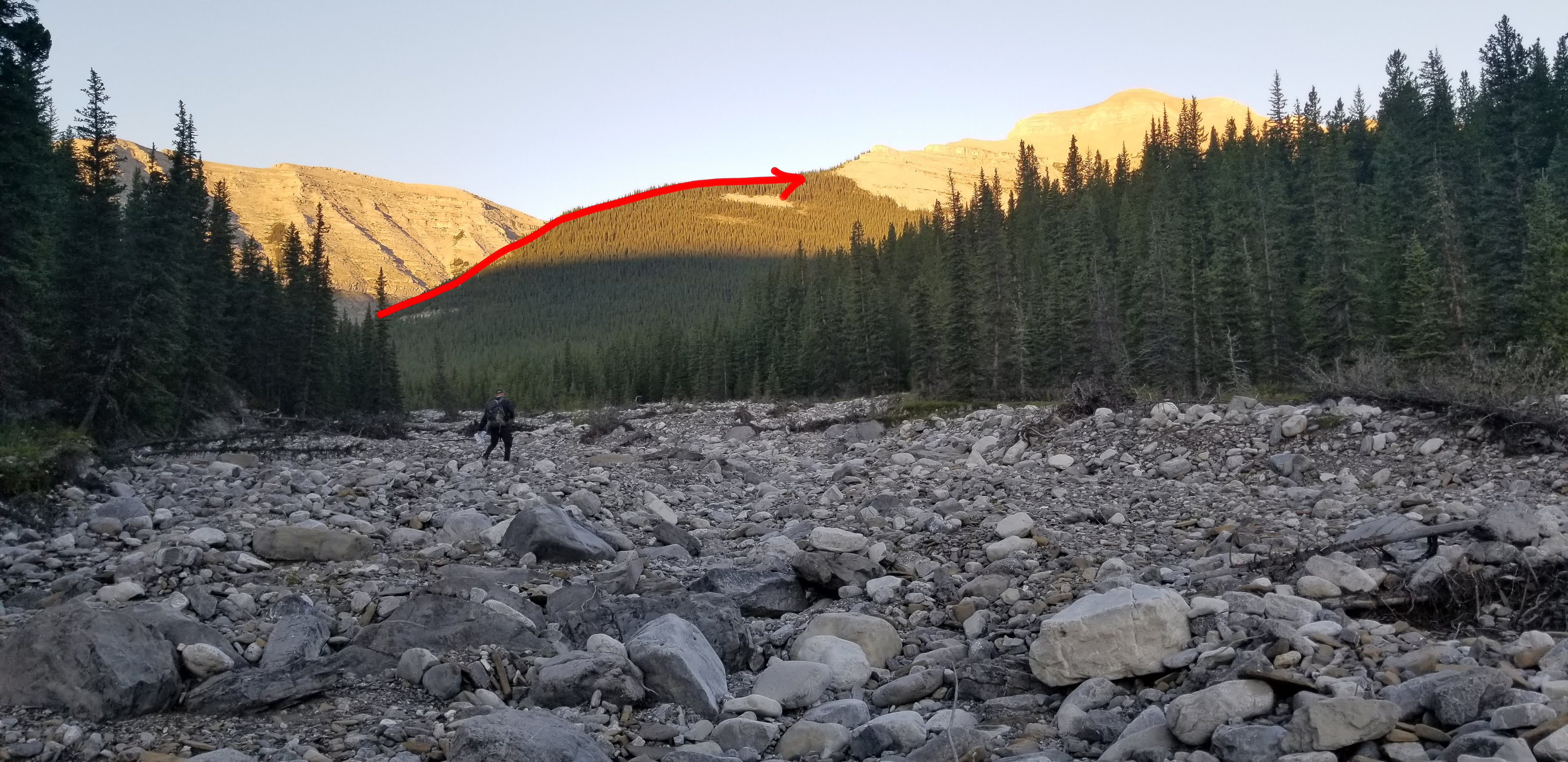
photo cred: Jessica Jiang
We stuck to the creek bed, then gained Glasgow's east ridge (marked on the shot).
There's not much of a trail, we stuck (loosely) to the ridge all the way to the tree line. It's a little bushwhacky, but not too bad. Just bad enough to snag any clothing you might have hanging off your pack (I lost swim trunks up there one year).
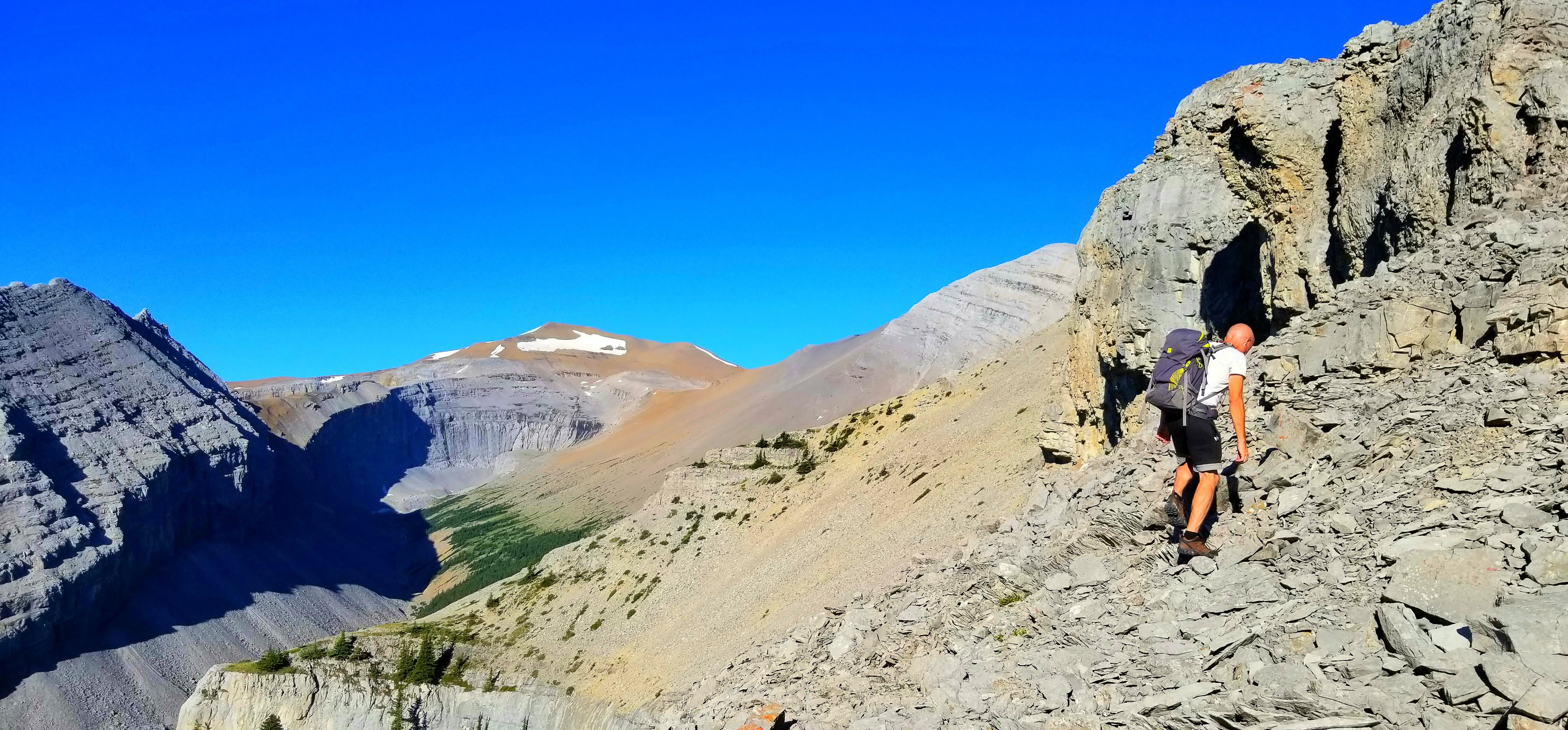
photo cred: Jessica Jiang
Typical rock terrain for this trip: route choices that limit movement to third class are obvious. That said, there are plenty of opportunities to bump up the difficulty while keeping the stakes manageable on this scramble.
Hot day!
Temperatures rose into the early 30s as we ascended from the valley below.
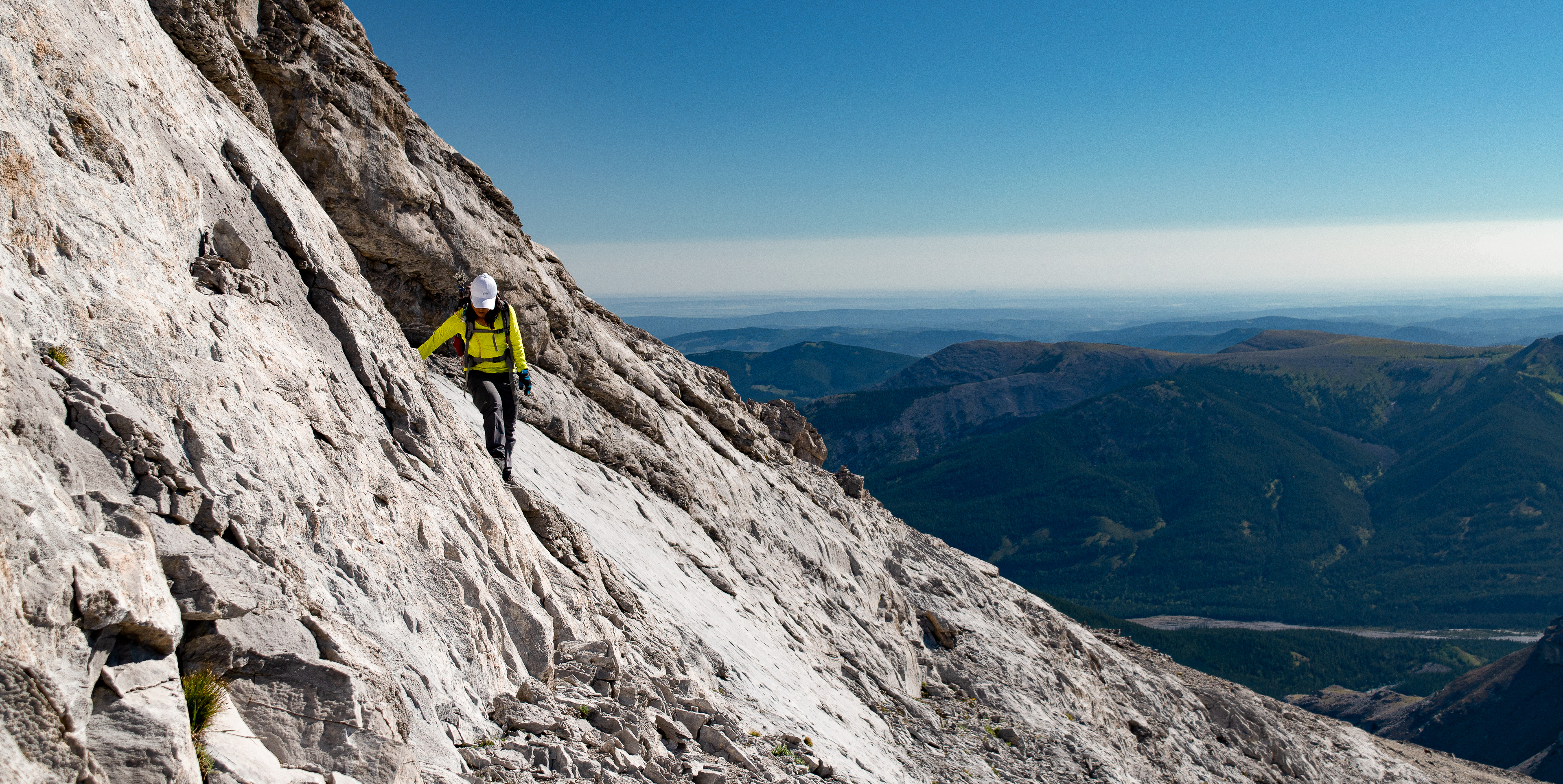
Views really start to open up as soon as we moved out of the tree line. Jess is fairly close to Glasgow’s summit here, scrambling a shelf along its east ridge
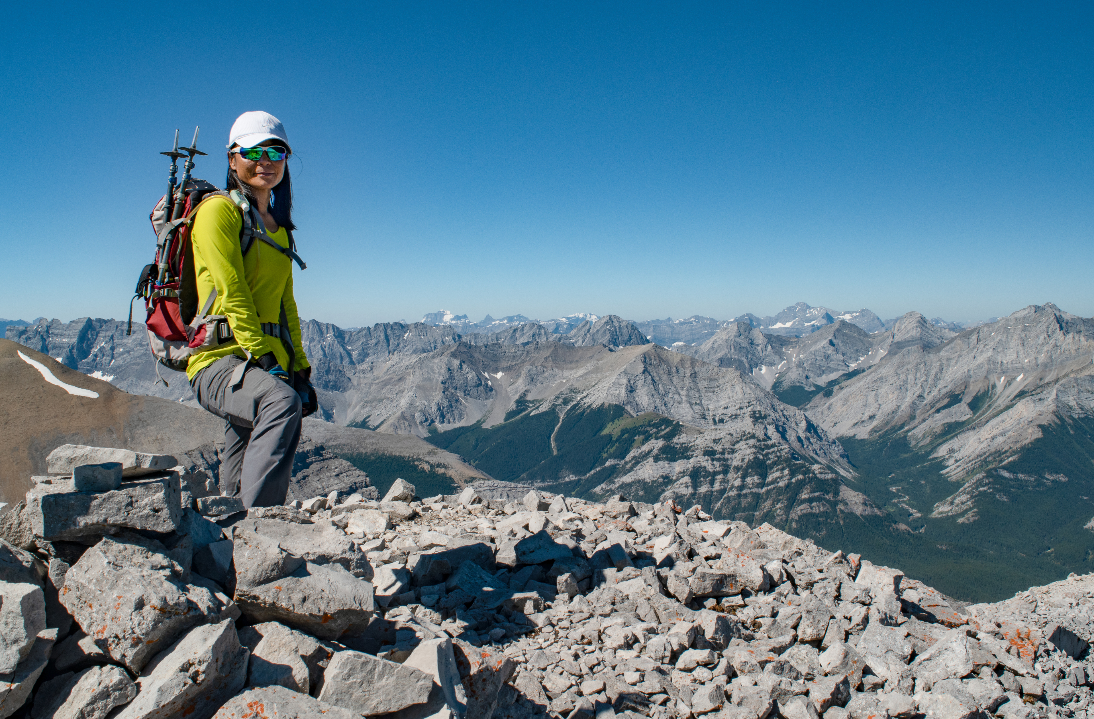
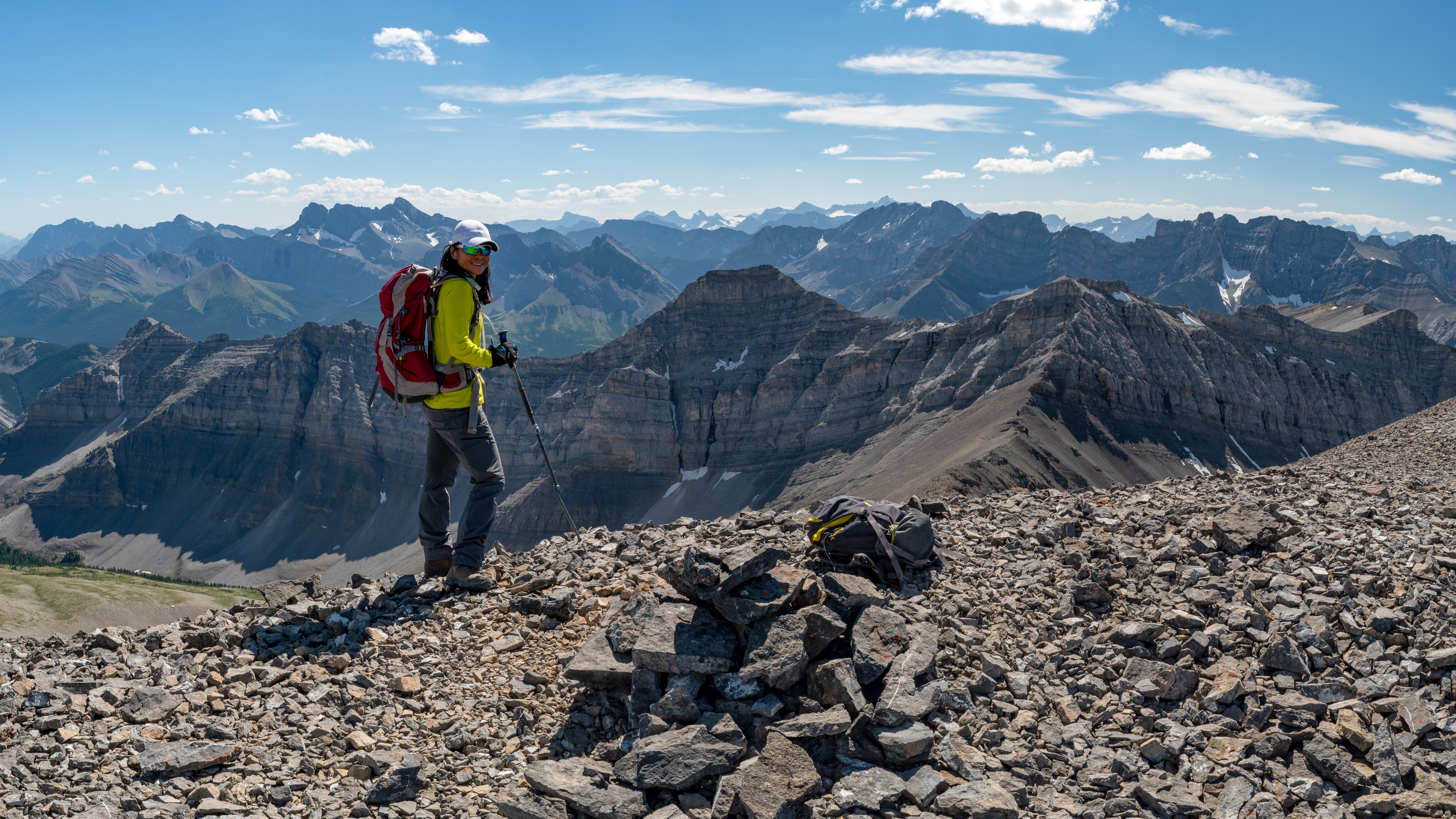
Jess stands on Mount Glasgow's summit.
That hat... how does it stay so white?
Amazing.
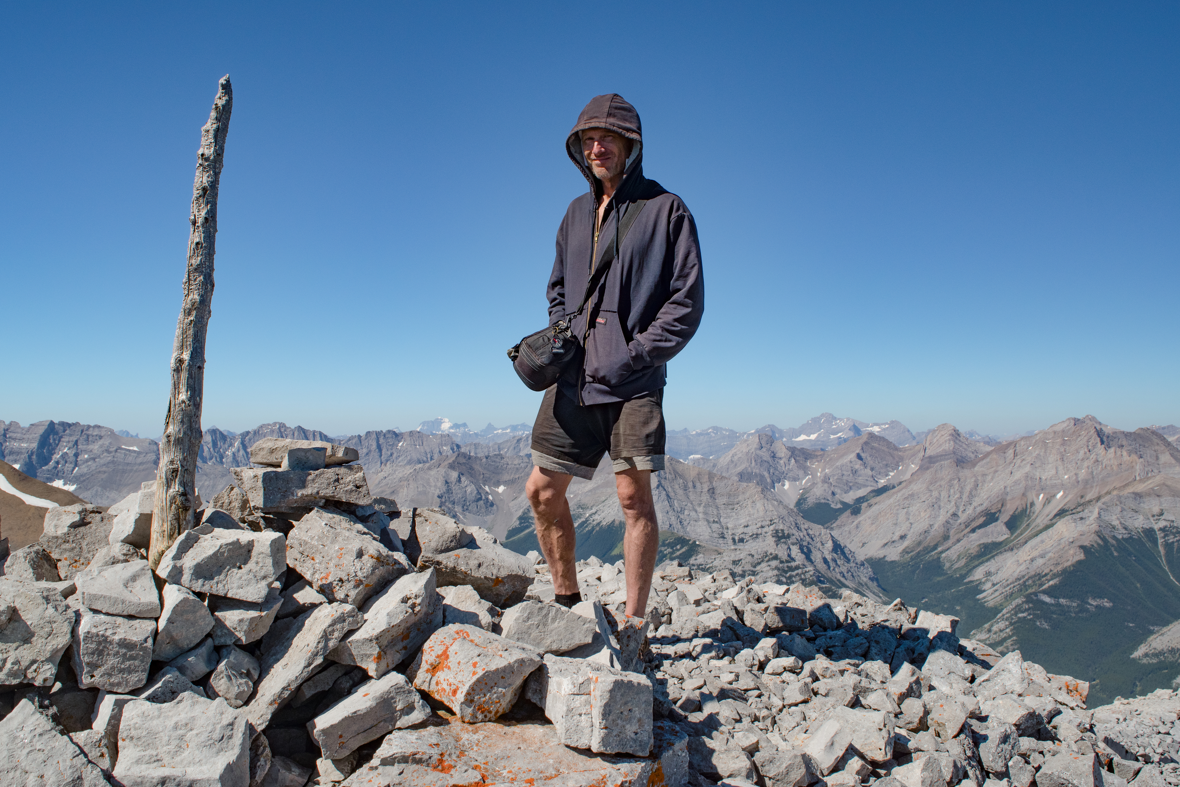
...your's truly...
(from Glasgow's summit)
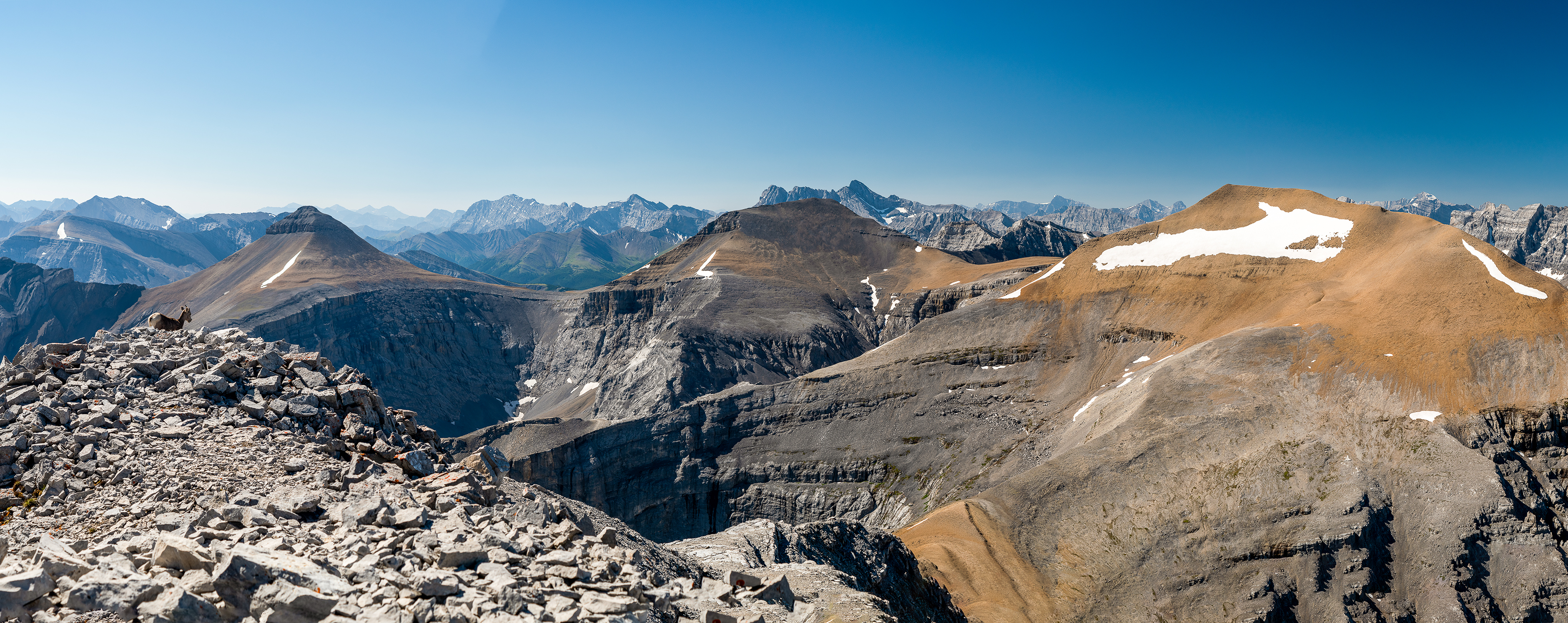
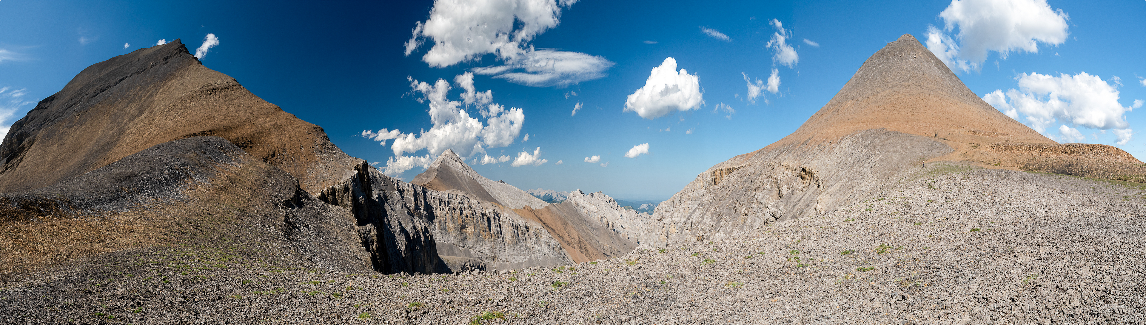
I stepped back from the summit enough to snap this pan of the rest of the Traverse. All four peaks share the same headwall and belong to the same cirque. Please excuse Sandy (exiting stage left), she had prior commitments and was unable to join us for the rest of the hike.
It was kind of her to pose for a few fantastic portraits.
Thank you, Sandy!
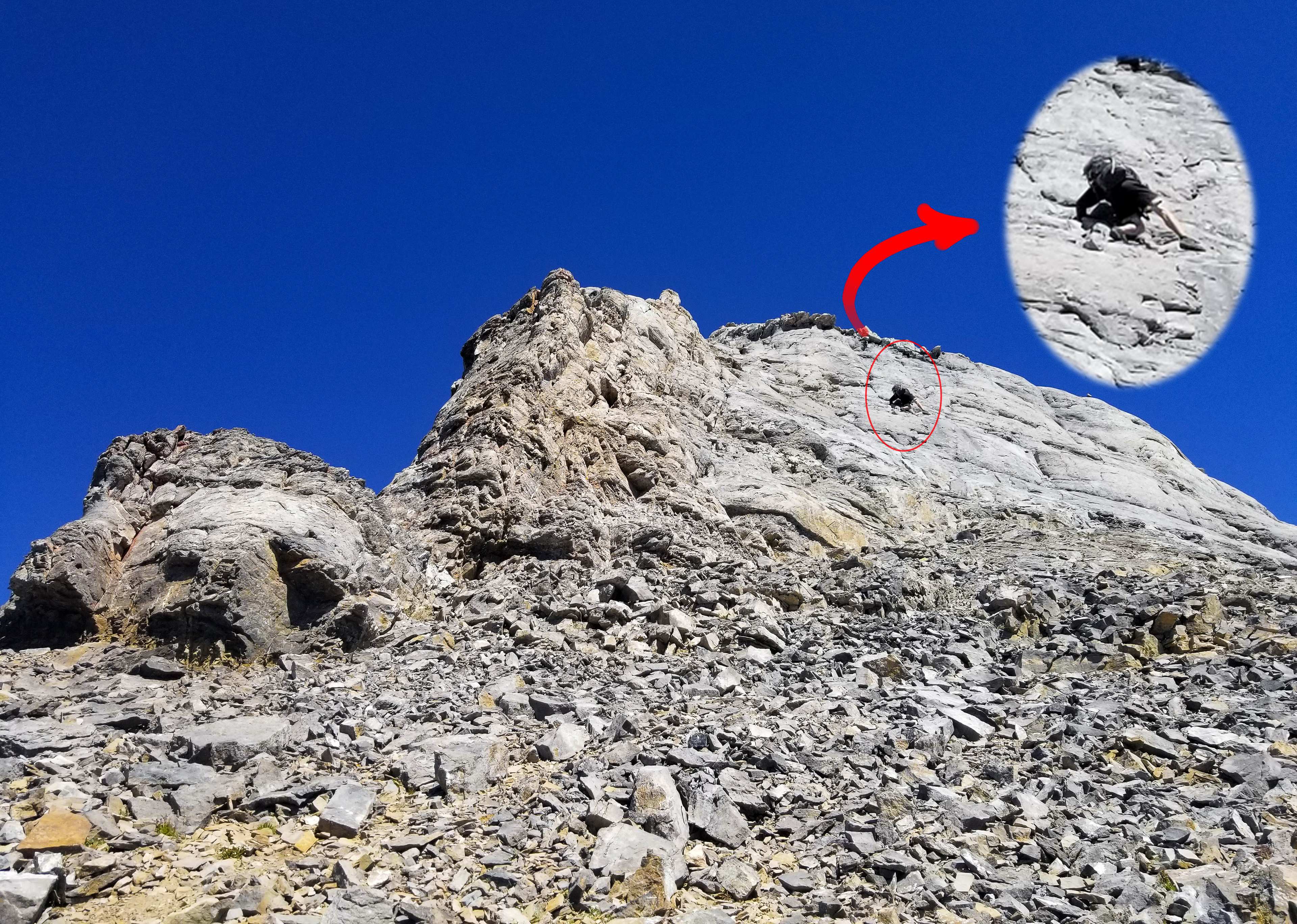
photo cred: Jessica Jiang
Fourth class, that is!
Jess snapped me traversing this rock wall on descending Glasgow's summit. It’s just fourth class here. Tricky, though. The ledges and holds are narrow and the rock isn’t good. A slip would sting and I could hurt myself, but there’s just not enough exposure to make fifth class. Not here.
Yet this same wall on a face with any significant exposure would merit a fifth class rating.
Pushing the envelope a little here pays off in higher-stake, more technically demanding terrain where being unable to free-climb would otherwise limit my options to roping up, finding another route or turning back.
There’s no question that a climbing wall, bolted sport routes and bouldering are helpful, yet I don’t think it’s enough. It’s not the same as real experience on real rock, unroped, no crash pads, and with a pack.
And it’s fun!
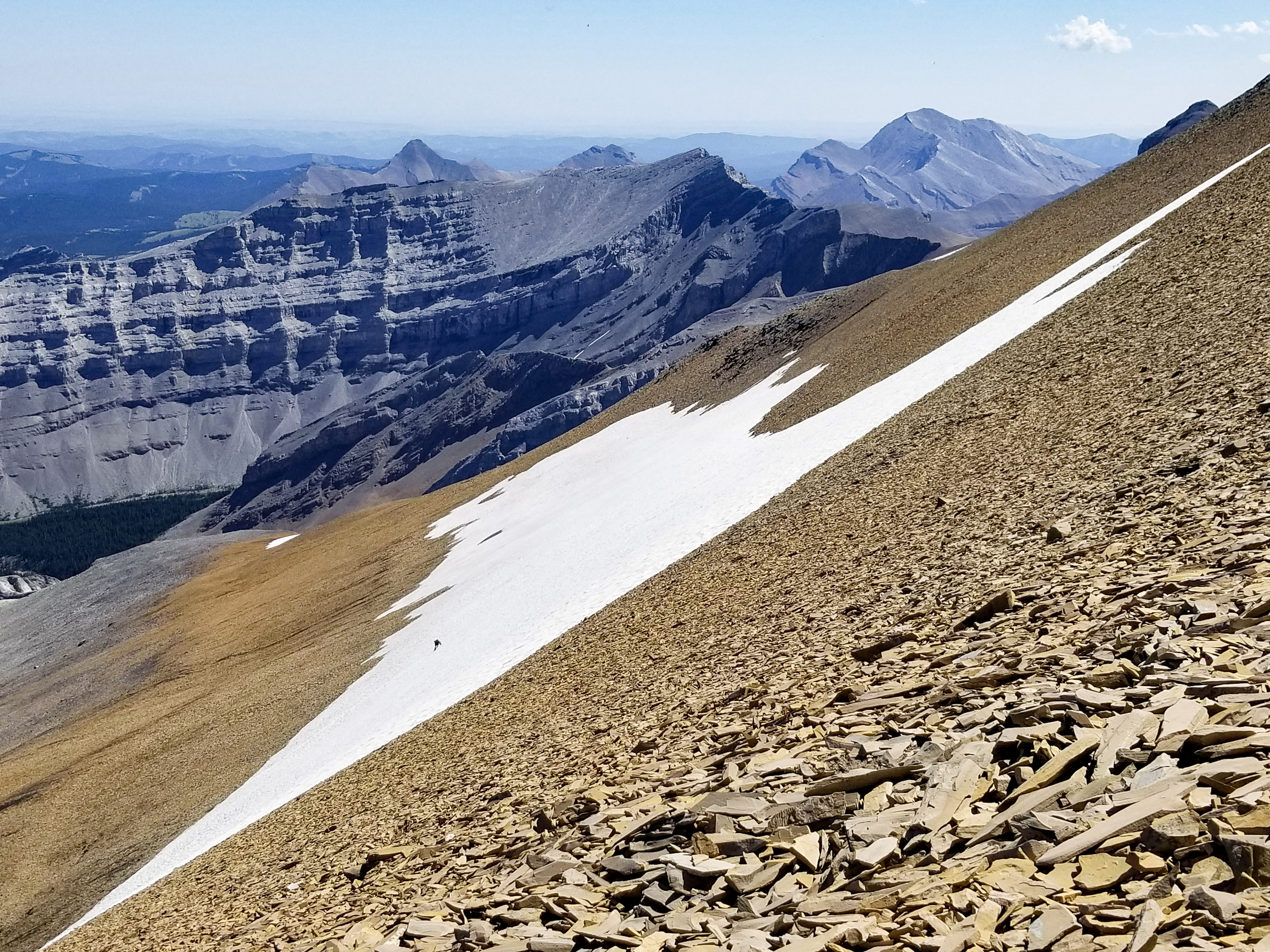
photo cred: Jessica Jiang
The scree and sediment act to filter the melt water and the water that emerges at the base of the pack (visible as the darkened bands that run roughly parallel) is superb! (**warning**: absolutely DOES NOT APPLY to glacial melt, which is ALWAYS horrible and can make you sick!)
I’m just visible as the blip near the bottom of the snowpack. A closer zoom would show me ascending in shorts and my trail runners, my shirt buried in my pack. Hot day! Jessica snapped this shot from the ridge. I had descended to the base of the snowpack for water.
(from Outlaw's summit)

...and that hat. How can it still be this white???
snapped looking southwest into the front ranges of the Canadian Rockies
Here's where it starts to hurt a little. There is more raw elevation drop to this col than the other two and, of course, we're about to gain it all over again to reach the last summit.
After having summited Glasgow, Cornwall and Outlaw.
Ouch.
(from Banded Peak's summit)
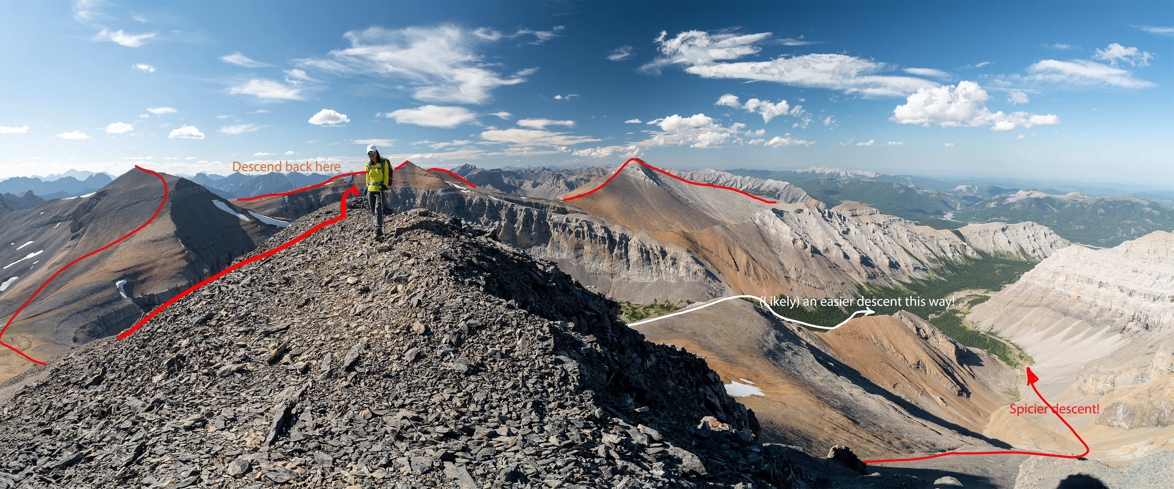
From here, we descended more of a gradual rise than a ridge for about two hundred meters, then dropped right (east) down the face. Daniel's route, and the route you'll now find posted on apps like Gaia and AllTrails, continue north and descend into the next valley. I haven't yet descended that way, though I suspect it nixes any fourth class terrain. It would likely nix some of the boulder-hopping along the creek bed as well. I tell myself I'll try the easier descent each time I'm up here, though I haven't yet. The downclimb is just too much fun!
Bike in from one of the day lots near the Little Elbow campground and stash your bike at the loop intersection where the creek that drains and runs down the middle of the cirque (South Glasgow Creek) joins the Elbow River. You'll switch out 7.2 km of the 33.2 km hike for an easy bike. The bike goes much quicker than hiking out, especially after having traversed all four peaks and is welcome relief if you're dealing with any cramps, blisters, etc. etc. We didn't pack bikes this trip, though I wish I had. It was the first (& likely last) time I didn't.
I hadn't read Vern DeWit's TR for this trip, he completed it back in 2004. I'll include a link in the references: he's consistently thorough, he writes well and the guy's a veritable living encyclopedia for matters Canadian Rockies. I'll include a link to Steven Song's TR for this route as well, for much the same reason. The link is to his Glasgow page: he breaks the four peaks across different pages on his site, though he completed them all as a traverse a few weeks after we were there in October.
All three sites (including Daniel So's, whose TR I did read) are worth a visit if you're planning to hike, climb or scramble anything in the Canadian Rockies, as well as Alan Kane's guide. Find links and references just below.
Thanks for stopping by, & I hope you like this TR!